
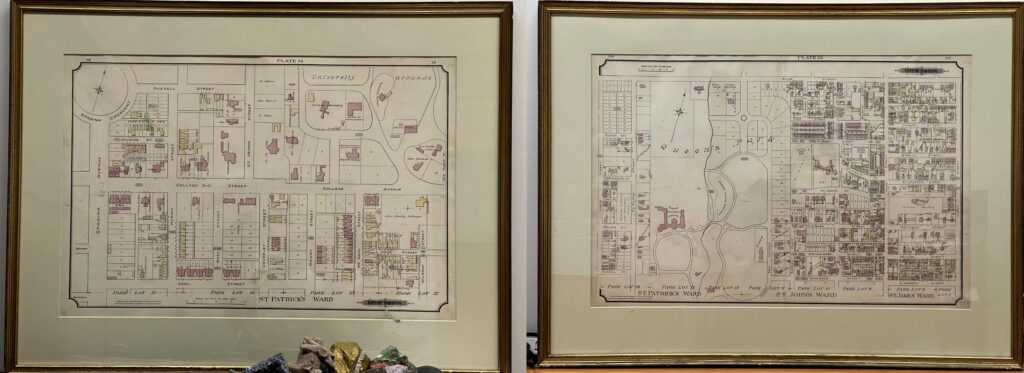
The Department has arranged a long-term loan from U of T Libraries of two historic maps from 1884. The illustrations show the U of T campus as it appeared over a century ago and is part of CivMin’s efforts to showcase our history during our sesquicentennial celebrations, known as Engineering 150.
The original artwork, from the Charles E. Goad Atlas of the City of Toronto, 1st ed., 1884, was provided framed from the existing holdings long held in storage. As there are additional and intact copies of the atlas, the loan was gladly made to showcase the otherwise hidden gem.
As part of Engineering’s sesquicentennial celebrations we encourage our community to explore our history and heritage at U of T via our events and Library archive resources.
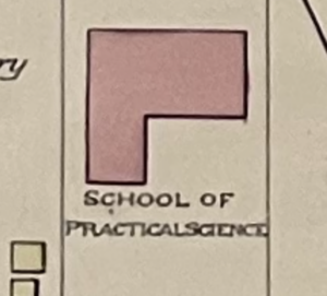
Those with a keen eye can spot a red brick schoolhouse, the School of Practical Science (named after the transition from the School of Technology, as it was known in 1872), as well as the absence of our present-day Galbraith Building (named for the first dean of Engineering, Prof. John Galbraith). The maps are on display in the Office of the Chair reception area.
By Phill Snel