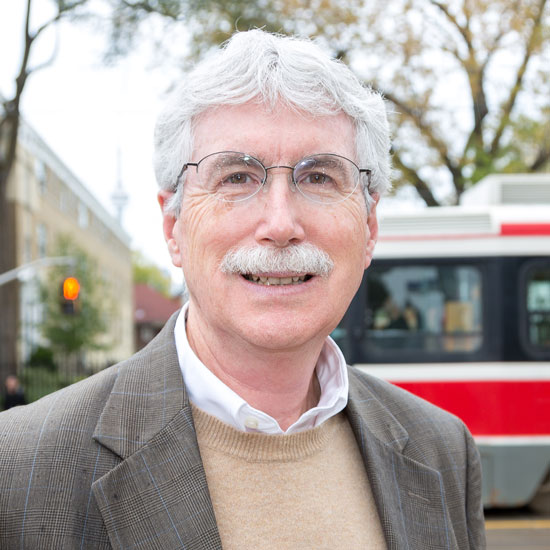
Eric Miller
Professor
Department of Civil & Mineral Engineering
Email: eric.miller@utoronto.ca
Office: GB305
Tel: 416-978-4076
Integrated Land Use and Transport Modelling
Background
Eric Miller focuses his research investigations within the area of transportation modelling and sustainable urban design.
Professor Eric Miller is a pioneer in the development and application of agent-based microsimulation model systems in large urban contexts. His research is centred in the implementation of activity-based travel models for use in operational practice. This includes the development of integrated transportation-land use models that permit the analysis of the two-way interaction between transportation systems and urban form. His work serves to improve urban transportation best practices and policy decision-making and, thereby improves the quality of life in urban settings.
Professor Miller is Research Director of the Data Management Group (DMG), which for over 30 years has provided data to government agencies, private sector partners working for government, and university researchers in support of a wide variety of travel behaviour analyses and modelling activities. He is also Founding Research Director of the Travel Modelling Group (TMG), a research consortium that seeks to provide a forum and mechanism for inter-agency collaboration designed to improved travel modelling practice for all. Current GTHA transportation agency partners in TMG include Metrolinx, the Ontario Ministry of Transportation, the Cities of Toronto, Hamilton, Mississauga, Brampton and Vaughan and the Regions of Durham, York, Peel and Halton.
Professor Miller is the recipient of the 2009 ITE Wilbur S. Smith Distinguished Educator Award, inaugural winner of the University of British Columbia Margolese National Design for Living Award (2012), the 2018 IATBR Lifetime Achievement Award and the 2020 U of T Faculty of Applied Science & Engineering Safwat Zaky Research Leader Award.
Research Areas
Microsimulation of Urban Transportation - Land-Use Systems
My main area of research is the development of a comprehensive, integrated, microsimulation-based software environment for modelling urban transportation and land-use systems. Development of the Integrated Land Use, Transportation, Environment (ILUTE) modelling system is a multi-year undertaking of my research team. Microsimulation involves the modelling of the behaviour of individual "actors" within the urban system (persons, households, firms, vehicles, etc.). Overall system behaviour (population and employment distributions, transportation flows by mode, etc.) is then the sum of the behaviours of all the individuals within the system. While computationally intensive, microsimulation holds the promise of providing more accurate, more policy sensitive estimates of travel demand than current conventional modelling techniques.
Development of the ILUTE modelling system involves state-of-the-art object-oriented programming methods, development and implementation of a wide variety of behavioural sub-models, use of a variety of novel data collection procedures to obtain the dynamic, micro-level behavioural data required to develop these sub-models, and a wide variety of other individual research projects suitable for student involvement at the bachelor's, master's and Ph.D. levels.
Sustainability of Urban Transportation Systems
In parallel with my more formal modelling efforts, I also am involved in the empirical analysis of the relationship between urban form, transportation system configuration and the energy efficiency/environmental sustainability of urban transportation systems. This work involves the statistical analysis of both observed and modelled travel behaviour, as well as the use of Geographic Information Systems (GIS) for the analysis and display of spatial data.
Improvements in Conventional Travel Demand Models
Over the past number of years I have developed GTAMODEL, a multimodal, regional transportation modelling system for the Greater Toronto-Hamilton Area (GTHA). This advanced agent-based microsimulation model system is used by the City of Toronto, other GTHA planning agencies, and an increasing number of urban regions worldwide, to analyze and forecast travel demand for a wide variety of planning and policy analysis purposes. Ongoing evolutionary development of this EMME/2-based model system provides the opportunity for student research topics in all areas of activity-based travel analysis and modelling.


